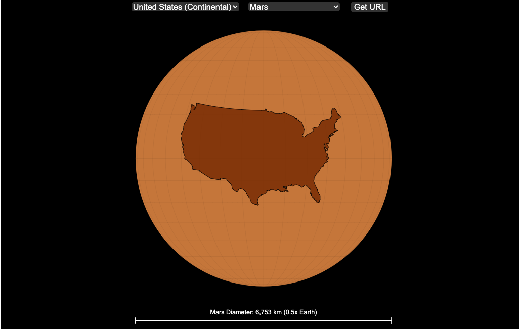
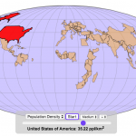
We can compare the sizes of countries and continents to planets and moons by projecting a map of a specific country onto another planet. Select a country and planet or moon to find out.
In one of my kid’s favorite books, there’s a picture demonstrating how Pluto is the same size as Australia. It has a satellite image of the country and an image of the former ninth planet superimposed on top as if it were hovering above the country. That image has stuck with me and I thought it would be interesting to see how other countries would compare with other planets and bodies in our solar system. As I’ve been working with javascript graphing/mapping library, D3.js and making maps/globes, I realized I should try to “project” individual countries onto these planets to see what they looked like.
Instructions
This visualization should be pretty self explanatory. You can select a country or continent and a planet or moon (or the sun) in the solar system. The visualization will then project the land onto the body and you have a simple visual comparison of the size of the country/continent and the planet or moon. You can drag on the visualization to rotate the planet.
There are some combinations that are not possible because the country/continent is too large to be projected onto the body without overlap. In these cases, the planet or country will be greyed out in the selection menu. You can click the “Get URL” button and share a specific map combination (country and planet) by copying the address in the url address bar.
The visualization also displays the area of the country/continent and the surface area of the planet or body. In some cases, the percentage may not look correct but remember that you can only see half of the planet surface and that it’s actually a hemisphere (half a sphere and not just a circle). It becomes clearer if you draw the surface of the planet around.
Calculations
The calculations to project a country onto another body involves starting with a set of coordinates (made up of longitude and latitude values) which define the border of the country, in the geojson format. To display them on Earth, the coordinates are modified so that the center of the country is centered at the intersection between the equator and prime meridian [0 deg latitude, 0 deg longitude].
To display them projected on a different planet or moon, it is necessary to change the latitude and longitude values of each point of the polygon country border so that it represents the same distance away from the polygon center. I used the Haversine formula to calculate the distance and bearing between two points on a sphere and then used the inverse to find the coordinates that were that distance and bearing from the center point on a sphere of a different size. These formulas can be found here. The main idea is that the distance representing one degree of latitude on Earth will be half as large on a planet that is half the size of Earth (like Mars). Thus, the distance between the center of a country and a point on the border will be a different number of degrees latitude and longitude from the center point on a different planet than on Earth. And this calculatin is done using these formulae.
Sources and Tools:
This visualization was made using the open-source, d3 javascript dataviz library and UI are made using HTML, CSS and javascript.
14 Comments »
14 Responses to Countries Mapped onto Solar System Bodies
Lots of very cool stuff on your site. Really creative! Thanks for reviving the digits game.
Interesting to project various countries and continents onto the planets. It’d also be interesting to project countries into each other to compare relative size.
You have links to the various tools you’ve used, thanks. Any pointers to tutorials on the basics would be appreciated.
What The….. https://engaging-data.com/mapping-countries-planets/?c=203&b=11
I Broke Pluto
Does Anyone Know Why GreenLand Is Smaller Than Australia???
Because it is smaller then Australia. The map you typically see is incorrect. https://www.thetruesize.com/#?borders=1~!MTUzMjYwMTg.NTMzMDg0MQ*Mjc3NDYwNjQ(OTc0NjA2NA~!CONTIGUOUS_US*MTAwMjQwNzU.MjUwMjM1MTc(MTc1)MA~!IN*NTI2NDA1MQ.Nzg2MzQyMQ)MQ~!CN*OTkyMTY5Nw.NzMxNDcwNQ(MjI1)Mg
True
Can I get on your contact list?
yes there is a email subscribe form at the bottom of the page
Why Brazil over Pluto is disabled?
https://engaging-data.com/mapping-countries-planets/?c=28&b=11
It is too large to display on Pluto
This is awesome! But I think some of the calculations are off. I just saw “United States (Continental) (8.0 million km²) is 643.7% of Pluto’s surface area (1.2 million km²)”
thanks, yes I fixed it the issue causing that problem
There is a weird chunk bitten out of ‘Ireland’ – the island’s name is Ireland, so you should put in the whole thing!
thats the uk lol