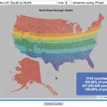
How is population distributed by latitude and longitude
This interactive map shows how population is distributed by latitude or longitude. It animates the creation of a bar graph by shifting population from its location on the map to aggregate population levels by latitude or longitude increments. Each “block” of the bar graph represents 1 million people. Population is highest in the northern hemisphere at 25-26 degrees North latitude and 77-78 degrees East Longitude.
Instructions:
It should be relatively explanatory. Press the “Aggregate Population by Latitude” button to make a plot of population by line of latitude (i.e. rows of the map).
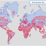
Press the “Aggregate Population by Longitude” button to make a plot of population by line of longitude (i.e. columns of the map). To see the population distributed across the map, press the “Show Population Grid” button.
This map was inspired by some mapping work done by neilrkaye on twitter and reddit.
Data Sources and Tools:
This map projection is an equirectangular projection. Data on population density comes from NASA’s Socioeconomic Data and Applications Center (SEDAC) site and is displayed at the 1 degree resolution. This interactive visualization is made using the awesome leaflet.js javascript library.

6 Comments »
6 Responses to World Population Distribution by Latitude and Longitude
Gráficos super interessantes!
This helped a lot for my quiz. I got 99/100. Thanks!!
Im a gamer *omongus emoticon* *sunglasses emoticon*
So good. Thanks so much to the author team for this great idea!
I’d always wondered about this in a slightly different context — population by time zone. Are you aware of any datasets that might be a good starting point?
Time zones correspond mostly with longitude. Thinking of the globe viewed from the poles, divide 360 degrees by 24 hours.