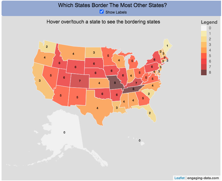
Interactive Choropleth of the Number of States That Border Each State
This is a fun little map that shows the number of states that border each state. I’m working on improving the interactivity of maps and this was a good project to try this with. The base map is a choropleth map which color codes each state by the number of states it shares a border with. If you hover over (or touch on mobile) a state, it will highlight the state and show you (and list) the bordering states.
It’s important to note that officially New York and Rhode Island share a water border (between Rhode Island and Long Island, NY) and that Michigan and Minnesota also share a border (in Lake Superior).
Sources and Tools:
Data on state borders was downloaded from state.1keydata.com. And the visualization was created using javascript and the open source leaflet javascript mapping library.

1 Comment »
One Response to Which State Borders the Most Other States?
Illinois borders 5 states, not 6 states as stated here.
Minnesota borders 4 states, not 5 states as stated here.
Michigan is bordered by 3 states, not 5 states as stated here.
New York is bordered by 5 states, not 6 states as stated here.