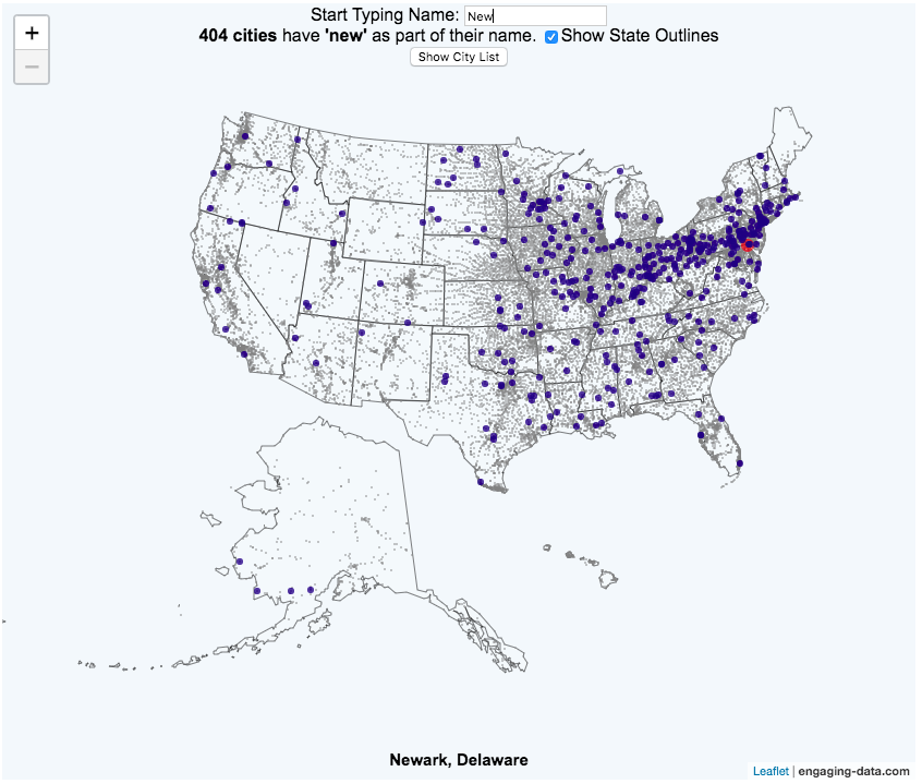
This map of the United States visualizes over 28,000 cities in the 50 states. The interactive visualization lets you type in a name (or part of a name) and see all of the cities that contain those string of letters. The points on the map show the geographic center of each city.
For example, if you type in “N”, you will highlight all cities that start with an N in the US. As you type in another letter (e.g. “e”, it will narrow down the cities that begin with those two letters (“Ne”). It will progressively narrow down the number of cities as you type in more letters. You can see an scrollable list of the cities (ordered by city population) that contain the string of letter that you have typed.
You can click on the check box to show or hide the outlines of the states.
Sources and Tools:
City name and location data was downloaded from simplemaps.com. And the visualization was created using javascript and the open source leaflet javascript mapping library.
No Comments »