**Check out the new reservoirs dashboard**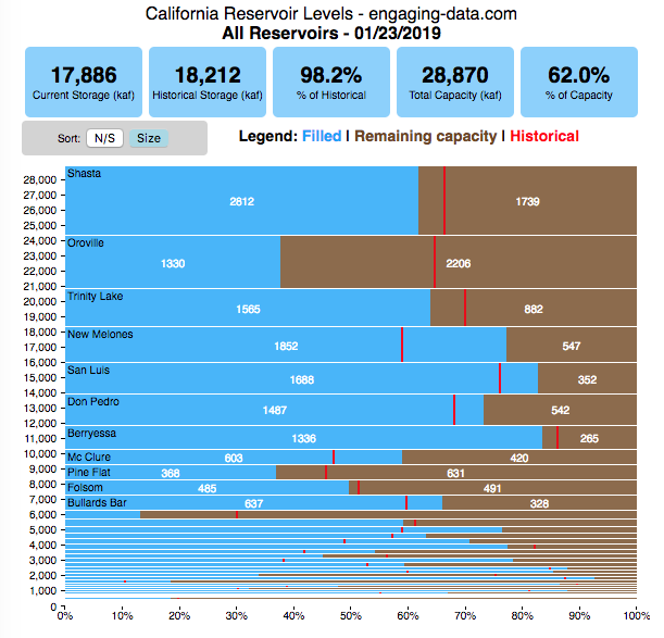
California has had an issue with drought, especially for the past few years now. Recently, 2016-2017’s El Nino weather patterns has brought a significant amount of rain to the state and helped alleviate some, but not all, of the major issues.
I’ve been very curious to understand how the rain storms we experience are lessening the impact of the drought, and whether one wet season (like 2016-2017) can really “get the state out of a drought”. One way to assess this is to look at the status of California reservoirs.
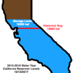
I created this stylized “bar” graph to show the total current status of 46 reservoirs in the state (it is updated daily and shows yesterday’s reservoir level). The figure represents the total of these reservoirs using the outline of the state as a “container” which can “filled up”.
- The blue is the current water level (in kaf or thousands (k) of acre feet (af) of water1Units: An acre-foot is the amount of water that can cover an acre of land (43,560 square feet or 4047 square meters) at a depth of 1 foot. This is equivalent to 43,560 cubic feet, 325,851 gallons, 1233 cubic meters, or 1.2 million liters. Crazy units.).
- The top of state represents the full capacity of all 46 reservoirs (~27 million af) and is colored brown until “filled”.
- The red line is the historical average level of the reservoirs at the same time of year (e.g. March 8th) between 1960 and 2010.
- Check out an animated version of this graph.
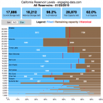
This second graph shows the historical storage levels of 46 of the largest reservoirs in California from 2009 until the present. The top 10 reservoirs are shown individually, while the remaining 35 are grouped together in the “Other” category2The names and codes of all 46 of the reservoirs I am tracking can be found on the California Department of Water Resources website – http://cdec.water.ca.gov/cgi-progs/reservoirs/RES. Hover your mouse over the graph to get data about specific reservoirs on a specific date (a popup on the cursor or on the legend). The total storage level can be compared to the historical average total reservoir storage levels. You can also zoom in to look at a specific time period via the scroll bar or by dragging the cursor between to dates.
As you can see, 2010-2012 was a relatively wet period, while the last couple of years have seen reservoir levels well below the historical average. Spring of 2013 was the last time before this recent drought that reservoirs were at or above their historic levels.
These graphs are created dynamically using data from the California Department of Water Resources (updated daily), so you can check this post occasionally to see how the precipitation are changing the levels of water in the state reservoirs.
early March 2016: Current California reservoir levels are significantly below the historical average. The winter 2016 rains are certainly helping the cause, but it’ll take time for the reservoirs to fully recover.
mid March 2016: The recent heavy winter rain storms have made a huge difference and the total reservoir storage is getting quite close to historical average. In fact, several reservoirs are near or above their historic average.
late March 2016: The storage in the reservoirs has jumped up dramatically in the past few weeks. Many of the reservoirs in the North are close to their capacity and are letting out water in preparation for the snowmelt. Reservoirs in the central and southern part of the state have less water.
January 2017: The huge storm in California has finally pushed reservoir levels above their historical average for the first time since the spring of 2013 (almost 4 years). Unfortunately, all that rain has been accompanied by a bit of flooding in some areas. Hopefully, snow pack and reservoir levels will hopefully continue to improve.
Summer 2018: The huge gains made in 2018 have mostly disappeared and reservoir levels are now back below historical levels again heading into the 2018-2019 water year.
Data source: California Department of Water Resources

Related Posts
Footnotes
| ↑1 | Units: An acre-foot is the amount of water that can cover an acre of land (43,560 square feet or 4047 square meters) at a depth of 1 foot. This is equivalent to 43,560 cubic feet, 325,851 gallons, 1233 cubic meters, or 1.2 million liters. Crazy units. |
|---|---|
| ↑2 | The names and codes of all 46 of the reservoirs I am tracking can be found on the California Department of Water Resources website – http://cdec.water.ca.gov/cgi-progs/reservoirs/RES |
17 Comments »
17 Responses to How Much Water is in California Reservoirs? – Current and Historical Visualization
Chris –
I love these visualizations! The CA ‘glass’ that fills up is very nice – I noticed that the total capacity here is different (lower) from the other reservoir graphs, and also the percent of current vs historical. Could these be made consistent / identical? thanks!
This IS excellent information Chris, thanks! Since last update we’ve had (still having) quite the ongoing rainfall so I look forward to coming back to see the new figures, visual portrayal of recent rains. Thanks.
This & the snow pack are great visualizations!
How about adding the data for water California receives from out of state reservoirs?
Excellent information! The last major reservoir built in California is the New Melones Reservoir in 1979. The reservoir infrastructure is old. The State needs this water, and the hydro-electric energy these reservoirs produce.
My pals in N. CALIF. told me the rain has been almost constant for weeks…
Im puzzled that the charts dont JUMP dramatically since the North supplies the SOUTH??
we keep allowing building and wonder why we re always short of resources.
cheers
keep up the great work. paul
Hi Chris,
How is the 27,320 Kaf Total Capacity for 46 reservoirs in the State on https://engaging-data.com/ca-reservoir-level/ be different from the 28,853 Total Capacity per “California Reservoir levels” on https://engaging-data.com/ca-reservoir-dashboard/?
Hi Teresa. Yes, they two charts cover different numbers of reservoirs. I had been meaning to align them but forgot about it.
Hi Chris,
Is it possible to get the Chart for 46 reservoirs in the State on https://engaging-data.com/ca-reservoir-level/ for statistics as of 4/30/2021? or as of the last business day of the month if the following day (or the date the chart is available) is on a weekend?
Hi Chris,
How can I get the chart for the CA reservoir levels as of 2/26/2021? I had failed to take a screenshot on 2/27/2021.
As you progress the pattern after looking at over 100 years of well data California is at peak drought every 7 years or so.
After years of drought, Northern California has so much water that the state’s two largest reservoirs are releasing water to maintain flood-control safety.
It looks like you have stopped updating this? Alas…
Hi Mattie,
I have a glitch in my python code that prevents it from updating. I’m still figuring it out, but I updated it manually so the data is mostly recent. I will try to get it updating daily again soon.
thanks for visiting
Chris
btw, you should share this page on https://www.reddit.com/r/dataisbeautiful
I submitted it. Check it out and upvote:
https://www.reddit.com/r/dataisbeautiful/comments/4bswed/california_reservoir_storage_levels_current_and/
Nice work Chris! Your graphs are exactly what I had been trying to update for the last year. Thanks for taking that off my to-do list!
thanks! glad to help out