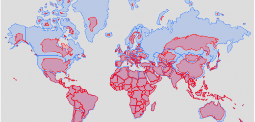
Real Country Sizes Shown on Mercator Projection (Updated)
Hover or click on a country to see how much it shrinks from the Mercator projection size. Check out some other engaging and interactive map dataviz: Hours of Daylight by Latitude/Season Country-Centered Maps Population by Latitude and Longitude Assembling the World Country-by-Country Where is all the water on Earth? Airplane Flight Emissions I remember as … Continue reading Real Country Sizes Shown on Mercator Projection (Updated)
16 Comments